Location: Riechheim
Locator: JO50NV 50°52.70′ N 11°07.23′ E, 410 m a.s.l. aprs.fi/#!call=a%2FDL2AKT&timerange=3600&tail=3600
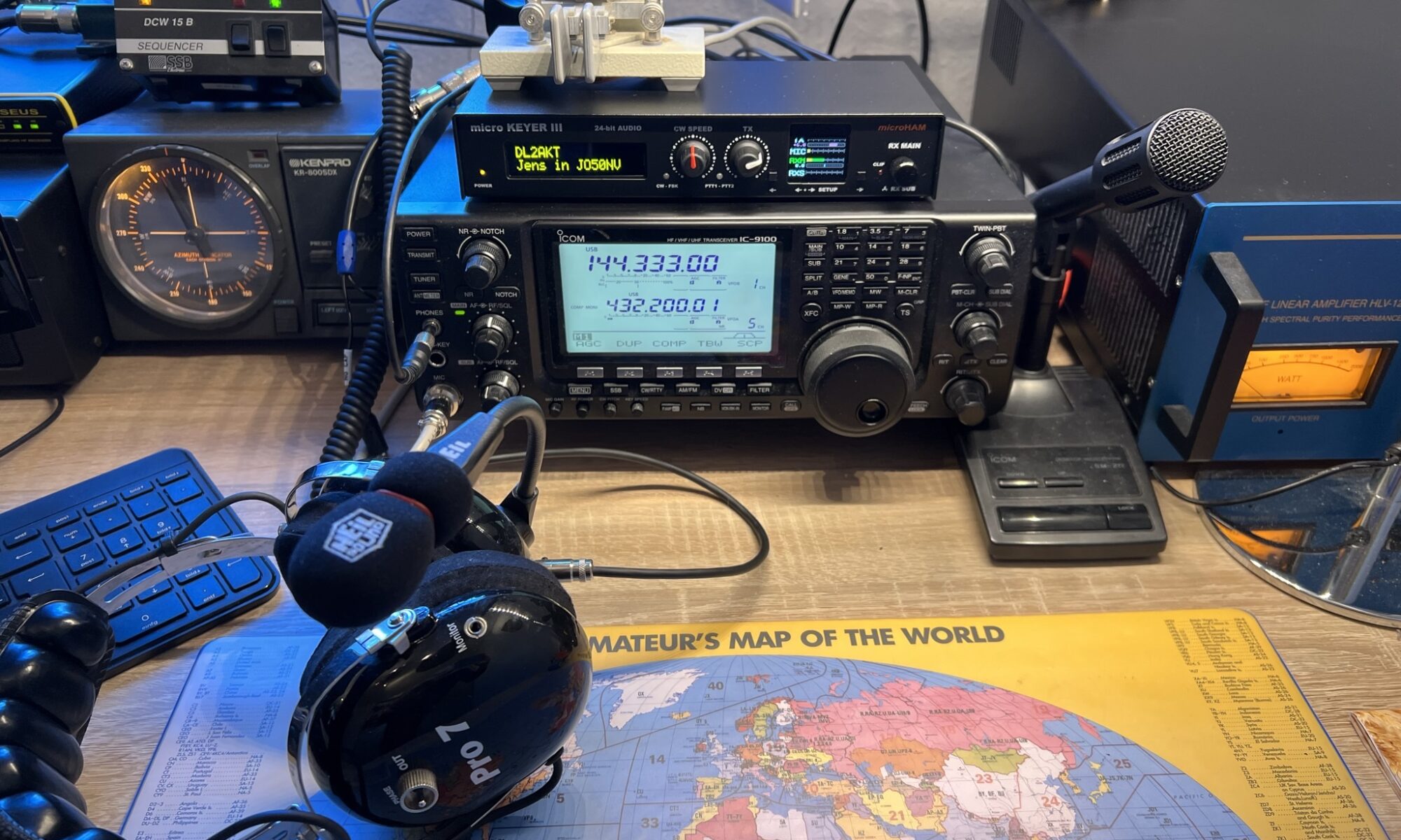
Equipment: IC9100 (1.8 MHz…1296 MHz) allmode TRX running with Microham MicroKEYER III.
Elecraft KX3 /w panorama adapter.
FTM-400D (144/432 MHz) FM , C4FM.
HLV1200 (144 MHz LDMOS PA).
Antenna System: LW (1.8/3.5/7 MHz & WARC), FB33 (3 Ele) 14/21/28 MHz, 9 Ele 144MHz, 16 Ele 432 MHz, 16 Ele 1296 MHz, X5000 , (144/432/1296 Vertical).
Perseus SDR with 144 MHz Converter.
Handheld TRX 144/432 MHz: FT3D (FM, C4FM), THD-72 (FM, APRS), RT3S (FM, DMR). TH-F7 (FM, SSB RX).
Portable equipment: IC-706 MK-2G, KX3
PI-STAR MMDVM Duplex Hotspot on Raspberry Pi Zero, see brandmeister.network/?page=repeater&id=2629197
DJSPOT FM Hotspot on Raspberry Pi Zero running svxlink software connected to FM-Funknetz (user DL2AKT-DJ) and Echolink (DL2AKT-L, node 14004)
Weather station DAVIS Vantage Pro2 with APRS and Internet links, life weather data at dl2akt.de/weather/ or aprs.fi/weather/a/DL2AKT-13 or weather.gladstonefamily.net/site/AT753 or https://www.wunderground.com/dashboard/pws/IELLEB4
ADS-B (airplane location/flight data) Airspy SDR RX running on Raspberry Pi 5, feeding data to several hubs, including OV3T’s server which provides reliable data source for DL2ALF’s Airscout software. Antenna is 8.5 dBi omnidirectional with NOOLEC SAWbird+ ADS-B LNA+filter between antenna and SDR.
And a lot of equipment not used anymore, e.g. ATV.
My QTH has good take off from south to north west directions. North east is worst because of 100 m higher hill in 1 km distance. Below you can see the radio horizon calculated with DL2ALF’s Airscout software:
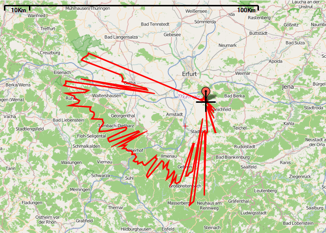
My QTH and equipment is good enough for 400km range in SSB and 800km in FT8 on 2m band with normal tropospheric propagation conditions.